Workforce dot planning and operations are at the heart of major events. But, it’s an immense task to plan and manage what can be tens of thousands of staff across multiple departments. Workforce are a significant event cost but crucial to their success. So getting the right number and keeping them happy is critical for safety, visitor experience and budgets.
What is dot planning?
Dot planning is the process of plotting the locations of staff across a space, to calculate total headcount and plan workforce operations. It’s usually achieved by printing a large scale map or drawing, and adding coloured stickers to represent staff member positions.
This type of dot planning is a time consuming, manual process. And is made almost impossible when working remotely. Additionally, it’s hard to bring the plans from different departments together to identify efficiency savings or gaps. It can get even more problematic as plans are refined and adjusted. Ensuring departments and workforce teams are aligned is a challenge.

A better way
Iventis offers organisers a better way to manage workforce dot planning and wider operational planning. Below we explain how this can deliver efficiency savings and ensure the best possible visitor experience, while keeping your workforce happy. For existing users, there is also a step-by-step guide to dot planning at the bottom of this page.
Large-scale events require a huge workforce. As an example, 40,000 security personnel were drafted in for the London 2012 Olympic games, which also included external partners such as:
- Private security firms
- Police
- The military
But there’s more
And that’s just for security. When you take into account other personnel who are needed to run an event — for example, volunteers, medics, stewards, drivers etc. — the number of staff can easily reach over 100,000. Getting a handle on these numbers early is essential for financial planning and budgeting. Even for an event with an army of volunteers, there are still associated costs such as food, uniforms and training.
Naturally, not all events are on this scale, but events that are more modest in comparison such as music festivals still require a huge number of personnel. Some events require close co-ordination between multiple agencies providing different staffing elements.
Real time plans with multiple access points
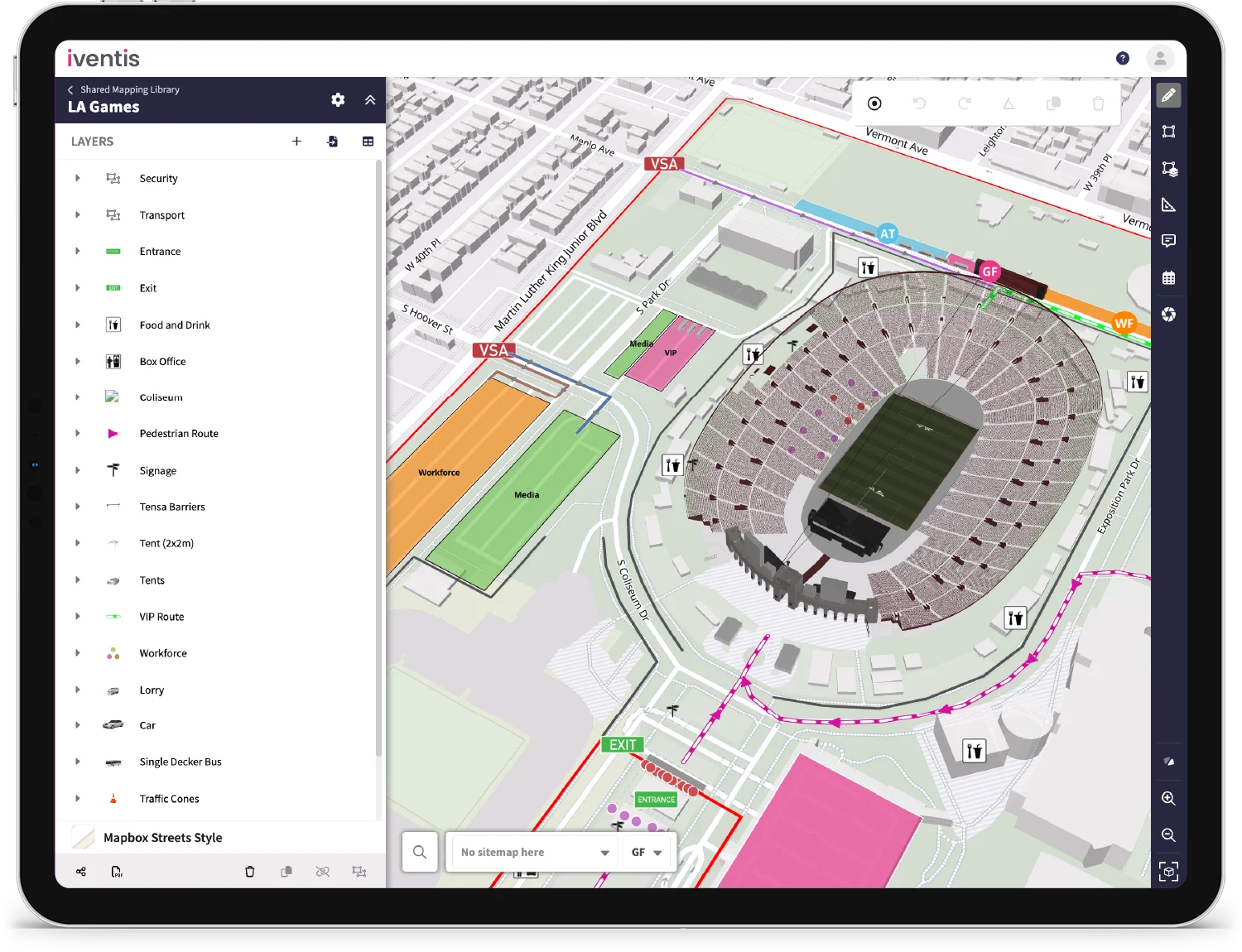
Using the Iventis Planner in real-time means everyone has immediate access to updated plans. If plans are refined or changed in response to budget cuts or other factors, everyone can stay up-to-date. Costs can be obtained and calculated, enabling managers to make more informed decisions.
One of the key Iventis Planner features is the seamless integration of city or country-wide mapping and architectural plans such as CAD drawings. This means the entire workforce can be planned in one place, whether it’s volunteers at train stations and remote transport hubs, or technical officials on the field of play. Every venue can be planned simultaneously, keeping this data in one place.
Every department or team can develop their plans which can be easily accessed on-premises, via the cloud and via the web.
Complete control
You can break down each sector into minute detail. Using our security example, you can station contracted guards at each entrance and exit, while plotting a route for other guards to walk at designated times. You are not limited to people either, other key assets such as patrol vehicles, CCTV cameras and anything else can be covered too.
You have complete control over how your plans are displayed. For example, different colours can be used for different functional areas, or shapes could indicate the type of staff.
In fact, you can capture a wide range of data about your staff using ‘attributes’, which could be hourly costs for contracted staff, radio call signs, equipment and anything else you need. All this data can be exported and analysed. You can even capture shift patterns, enabling a day-by-day or minute-by-minute timeline of staffing.
Iventis also integrates with ‘What3Words’, a system which divides the globe into 3x3m grids with a unique identifier. This could be used when deploying staff to specific locations. Equally, deployment plans could be exported or shared with links.


