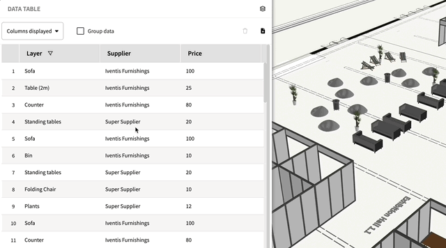
Users can now group data in an attribute table, either by layer or attribute, to instantly see total quantities, costs, or any other specifics. This advanced feature also allows users to group data by more than one level, such as by both venue and layer.
Grouping attribute data makes it easier for planners to keep track of total resources and be able to monitor budgets in real-time. To watch a short explainer video of how to use this feature, click here.
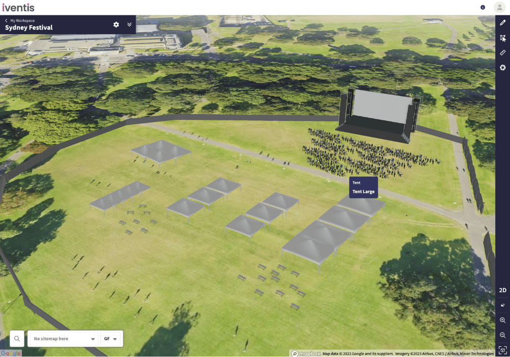
Users can now access the latest global satellite and aerial imagery from Google! Google provides one of the most extensive and detailed sets of imagery across the world.
This latest addition complements the existing collection of imagery providers, enabling users to select the most suitable background for their location.
Users can now:
"Iventis helped us to provide a solution-led, end to end service for organisers of The Game Fair from CAD drawings and live operational planning to a visual sales tool that helped mark out the site on the ground."

“The Iventis mapping software has been instrumental with plotting, measuring and storing the relay route on a secure platform. It allows relay planners to use the mapping software as a development tool, creating and amending the routes. Additionally, it allows for multiple user groups, with various access rights, to view or edit plans and see real-time route amendments. Plans can be shared via a link or exported in KML and PDFs files.”