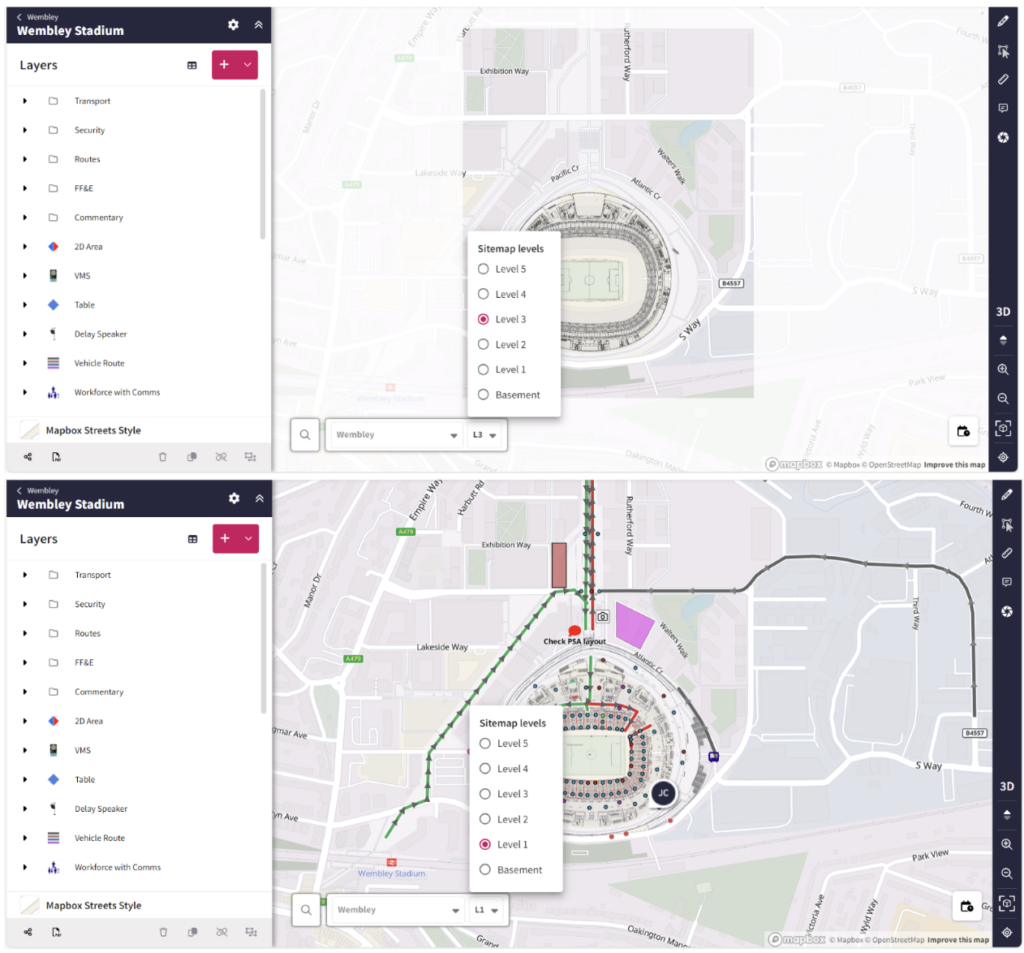
 Map objects are now attached to specific sitemap levels, and each level above ground features a frame that prevents users from drawing outside of these boundaries. This is so that users do not get confused between levels and draw on the wrong level, helping to reduce errors.
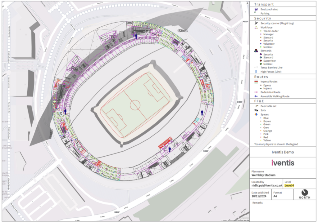 The legend of your PDF exports will now show which level is being displayed in the image. This helps differentiate the levels and add clarity for users working on large plans with multiple levels.
“We were happy to team up with such a renowned company as Iventis which significantly supported our team in their planning and delivery. The system was used across several functional areas to develop plans and co-ordinate our efforts in the run up to the event.”

"Iventis helped us to provide a solution-led, end to end service for organisers of The Game Fair from CAD drawings and live operational planning to a visual sales tool that helped mark out the site on the ground."