![]()
Icons can now be oriented relative to the map, not just the view.
You can now set the rotation angle of icons and choose between 3D (raised) or 2D (flat) appearances. Icons will automatically rotate to match your point of view.
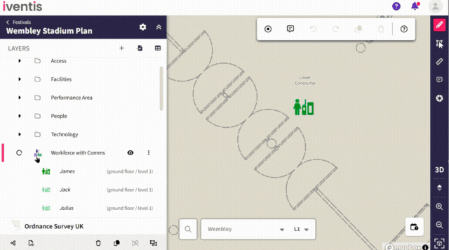
Users can now set a plan’s date and time using the date/time selector, which ensures map objects display only if they have a repeating date/time attribute that matches the selected range. Map objects without any repeating date/time attributes will be shown regardless of the selected date/time.
This functionality improves oversight of workforce shift planning. For example, if a steward is scheduled to work at a specific location on particular days or within a date range during an event, this new attribute allows users to see when stewards are on shift. This ensures clear visibility and efficient management of workforce schedules.
Improved navigation
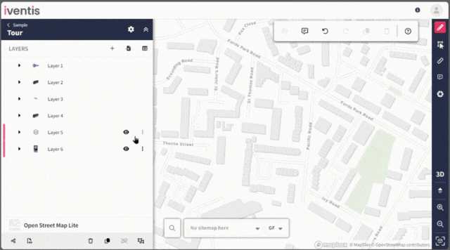
Clicking an object from the sidebar or attribute table now pans and zooms directly to that object on the plan.
This is particularly useful for plans with multiple layers and multiple objects, where locating a specific object can be challenging. Now, users can select an object from the sidebar or attribute table and the map immediately pans to the object, making it quick and easy to find exactly what you need.
Any duplicate or unused project attributes can now be deleted, provided they aren’t used in other plans. This will help to declutter data, making it easier to quickly add attributes to your layers.
Users can now view the level at which an object was created in an attribute table.
Whenever you export or download files, or comment on a plan, a notification will now conveniently appear in the form of bell icon in the top right-hand corner, keeping you informed of your activities.
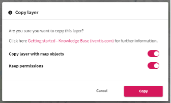
When copying or unlinking a layer, you can now choose to keep the permissions. Making it easier for you to retain the same access rights across any layer that you duplicate or unlink.
You can now add predefined project attributes to multiple layers at the same time. This will save you from having to add multiple attributes individually to each layer.
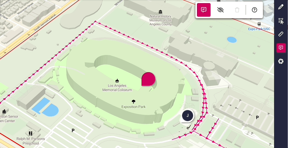
Our new comments feature enables users to collaborate effectively on their plans:
Stay tuned for additional enhancements to this feature in the near future!
Now, enterprise customers have the capability to configure Iventis to use their organisation’s identity provider for authentication. For example, users can login to Iventis using their company’s Microsoft Office account instead of needing a separate username and password.
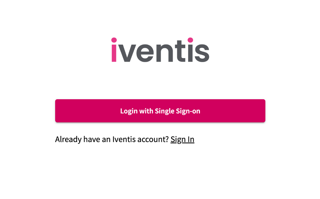
Single sign on functionality helps larger organisations manage access and ensures compliance with security policies.
Users will now be presented with a recommended selection of layer templates tailored on to their event type.
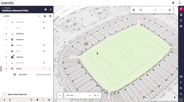
Users can now upload photos and images to map objects, using our new Image Attributes feature.
“Birmingham 2022 is the largest event to be held in the UK since London 2012. That means it is an incredibly complex operation for us to manage. Iventis allows us to knit all of those requirements together in a single platform. It’s absolutely fantastic and so useful across the supply chain for everybody to have access across all of the different venues and fantastic from an efficiency and commercial value perspective”

“The Iventis mapping software has been instrumental with plotting, measuring and storing the relay route on a secure platform. It allows relay planners to use the mapping software as a development tool, creating and amending the routes. Additionally, it allows for multiple user groups, with various access rights, to view or edit plans and see real-time route amendments. Plans can be shared via a link or exported in KML and PDFs files.”